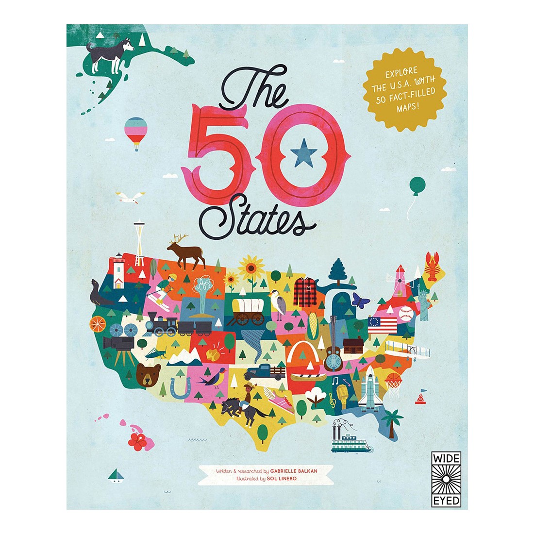
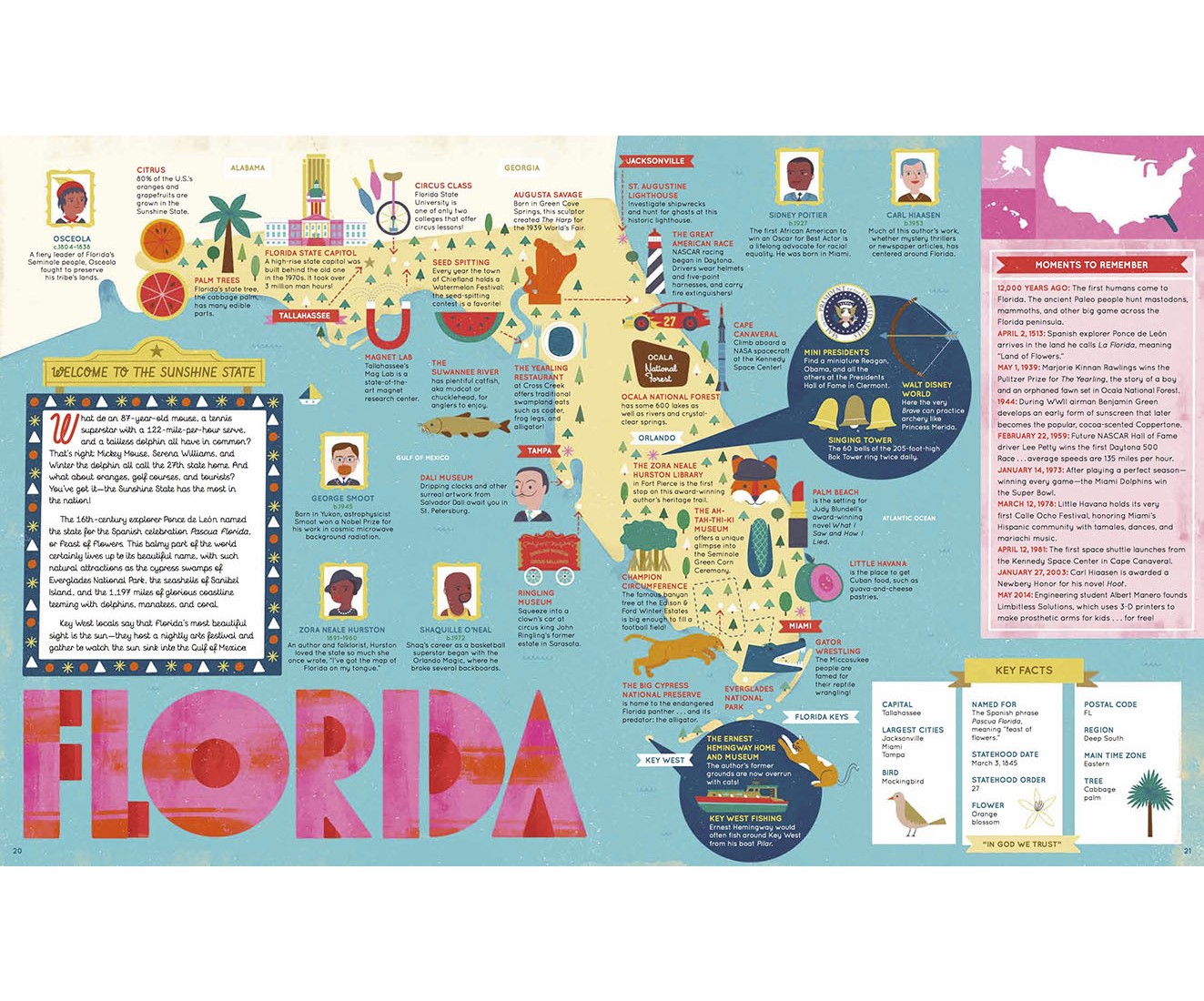
Ghost towns, swamp tours, the center of the universe…bacon donuts, brainy berries, salmon jerky…T he French Fry King, The Mother of Oregon, The Queen of Blues…be inspired by the inventiveness, beauty, and diversity of the United States in this curious collection of fact-filled maps.
On each wonderful map, find:
- A welcome box with a short introduction to the state
- Key facts, including the capital; state bird, flower, and tree; and statehood order
- State icons celebrating the state’s people, places, and history
- Six inspiring people who have a connection to the state
- Region spotlight bubbles to allow you to discover more about one particular place
- A moments to remember box with a list of significant dates and their events in the state’s history
Each state’s map also contains information about which states it neighbors, its bodies of water and borders, as well as where it is situated in the country. Did you know that while Hawaii shares its border with no one, both Missouri and Tennessee border eight other states? Many state parks, battlefields, national forests, and reservations are also included to inspire you to respect and explore the great outdoors.
So pack your bags and say later ‘gator…the great States await!
Hardcover, 112 pages
Ages 6+